 |
Mount-Chase
is a small town located in Penobscot County approximately twenty minutes from the town of Patten. Known as a relaxing "get-away," perfect for boating, fishing and hunting, the town of Mount Chase was first incorporated in 1864. It was later reorganized as a plantation in 1936, and then reincorporated as a town in 1979. It is home to Shin Pond and Upper Shin Pond, and offers lots of recreational opportunities, besides boating and fishing. Swimming is available at lower Shin Pond, with canoe rentals available at Shin Pond Village. Other activities include hiking, biking, cross-country skiing, snowmobiling, wildlife viewing (including moose, deer and black bear,) and birdwatching. The town is served by Maine Route 159, and shopping and restaurants are available in nearby Shin Pond Village and the town of Patten. A Lumberman's Museum is also an interesting place to visit in Patten. Mount Chase is also a short drive to Baxter State Park, which includes over 240,00 acres of wilderness that surrounds beautiful Mt. Katahdin, Maine's highest mountain peak, at 5,267 feet. The park has 180 miles of hiking trails, including the northern terminus of the Appalachian Trail.
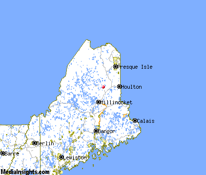
Surrounding areas: Patten, Maine (5.3 mi), Island Falls, Maine (12.4 mi), Oakfield, Maine (17.1 mi), Benedicta, Maine (20.0 mi), New Limerick, Maine (26.2 mi), Houlton, Maine (32.1 mi), Bancroft, Maine (36.4 mi)
|

|
Mount Chase Vacation Rentals
|

|
|
|

|
Mount Chase Hotels and Resorts
|

|
|

|
Mount Chase Weather & Climate
|

|
|
|
Maine's Northeast climate is four seasons and highly changeable -- it can go from sunny to stormy in short order. Summers in the Katahdin Region, near the Canadian border, are cool, with highs in the 70s or sometimes reaching the low 80s. Interior areas experience a greater range of temperatures in the summer, with some nights in northern areas near freezing. Winters in Maine are cold and sometimes even frigid. January temperatures range from 11 to 31 F along the coast and 1 to 19 F inland. The snow can be lovely, and if you aren't opposed to cold weather, wintertime is a great time to visit Maine. Continuous snow is generally on the ground from December through February and sometimes into March. Daytime highs gradually increase March through May. In September, the spectacular colors of fall blaze and sunny days and cool nights characterize this favorite season of many in Maine.
|
| Month |
High Temp |
Low Temp |
Rainfall |
Ocean Temp |
| January |
23°F |
2°F |
3.37 in. |
- |
| February |
27°F |
4°F |
2.39 in. |
- |
| March |
37°F |
15°F |
3.08 in. |
- |
| April |
49°F |
29°F |
3.54 in. |
- |
| May |
63°F |
41°F |
3.78 in. |
- |
| June |
73°F |
51°F |
3.94 in. |
- |
| July |
78°F |
57°F |
3.80 in. |
- |
| August |
76°F |
54°F |
3.95 in. |
- |
| September |
66°F |
45°F |
3.67 in. |
- |
| October |
54°F |
34°F |
3.70 in. |
- |
| November |
41°F |
25°F |
3.67 in. |
- |
| December |
29°F |
11°F |
3.45 in. |
- |

|
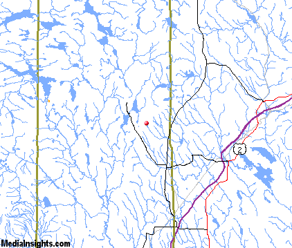
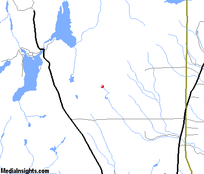
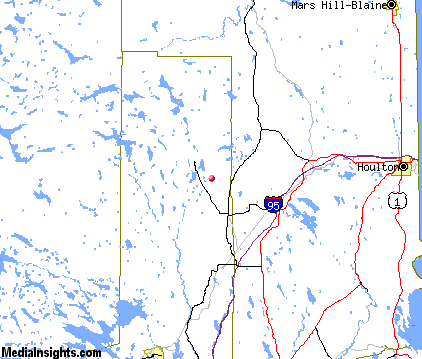
Mount Chase Map & Transportation
|

|
|
 |
|
|
| Click each thumbnail image to enlarge. |
 |
 |
 |
 |
The closest airports in the area are the Houlton International airport (HUL) located about 34 miles east of Mount Chase in Houlton, Maine, the Northern Maine Regional At Presque Isle airport (PQI) located approximately 47 miles northeast of Mount Chase in Presque Isle, Maine, and finally the Loring International airport (ME16) located roughly 66 miles northeast of Mount Chase in Limestone, Maine.
|

|
Mount Chase Attractions
|

|
|
| | | Water Parks |
| Odyssey Water Park | Trenton | ME | 113.8 mi. | |
| | | Golf Courses |
| Va Jo Wa Golf Club | Island Falls | ME | 12.4 mi. | | | Houlton Community Golf Course | Houlton | ME | 26.1 mi. | |
| | | Ski Areas |
| Big Squaw | Greenville | ME | 67.8 mi. | | | Sugarloaf USA | Kingfield | ME | 111.3 mi. | |
| | | State Parks |
| Baxter State Park | | ME | 21.2 mi. | |
| | | Museums |
| Northen Maine Museum of Science | Presque Isle | ME | 47.4 mi. | (Science) |
Notice a problem with the information on this page? Please notify us.
|
Disclaimer: We recommend you conduct your own research regarding all accomodations and attractions found on this website. The distances shown on this website are straight-line distances as the crow flies. The road distance may be considerably longer. You assume all liability for use of any information found on this website. No information is confirmed or warranted in any way. By using our services you agree to the terms and conditions of this disclaimer.
|
| We are the #1 site for your Maine Vacation presenting Maine vacation rentals, hotels, weather and map for each city. |
Maine Vacation .com
©1997-2025 All Rights Reserved.
|
|